Blue Hole -- The Scenic Route from Atlanta

I moved these directions to a separate file for brevity. If you travel to or from Blue Hole on US64 from Cleveland, Tennessee or other points west, you'll get to experience the scenic portion of this route along the river.
Note that I haven't travelled this route from Georgia up to US-64 in a few years, so some details might have changed.

The Scenic Route to Blue Hole

  1. Take I-75 North out of Atlanta.
  2. Just north of Cartersville, take the exit for US Hwy 411. At the end of the ramp, turn right. You're now heading north on Hwy 411.
  3. You'll be on this road for about 70 miles, first passing through Fairmount, then some small places and eventually, Chatsworth. You'll dance with a railway line, first to your left, then to your right. For most of the stretch your speed limit is 55 mph and there are some long open stretches where you can pass slower traffic. There are also some stretches with passing lanes. Beware speed-zones in the towns, since ticket revenue is pretty much how they pay their cops. :)
  4. After crossing the Tennessee state line it's 10-15 more miles to US 64. This will be the first highway overpass you see; railroad tracks will be on your right at this point. Take the lefthand turn before the bridge (sign says "to Ducktown, TN") and turn onto US 64 East.
  5. US 64 is four-lane divided at first, but goes to a well-laid two-lane road after a few miles. You'll pass a few touristy places: several whitewater outfitters, Mrs. B's Purple Bus, etc.
  6. You'll enter the Cherokee National Forest and come to TVA's Ocoee #1 dam on your right. It's worth a stop at the overlook to gaze down upon the dam. This marks the beginning of the scenic drive, and the road curves sharply to the left. These two photos of Ocoee #1 Dam were taken from the overlook.
  7. Continuing on US 64 past the dam you'll pass the Lake Ocoee Inn on your right, and the road becomes quite curvy. Parksville Lake will be on your right and you'll pass several beaches, boating ramps, etc. Keep going.
  8. The lake will narrow and so will the road, since it hugs the shoreline. The road gets really curvy and also somewhat congested during the summer rafting season, so be extremely careful and be wary of pedestrians often carrying kayaks, etc. This is a US highway and is used by 18-wheeler trucks, etc., so stay on your toes. Everyone seems to drive fast, yet I've never yet actually seen a wreck on this stretch. Amazing.... It's only a matter of time, though.
  9. You'll pass Ocoee #2 Powerhouse, a large brick TVA structure across the gorge. This is where the water falls down three green pipes from the wooden water flume and surge tanks on the ridge above. If you can snag a spot to park, this is also a great place to pull off and watch the rafters and kayakers in the river, on days when the water's running high in the Middle Ocoee (typically every day except Tuesdays and Wednesdays). This is pretty much the end of the Middle Ocoee rafting/kayaking segment, which you'll now be driving along until you get to the next landmark.
  10. Past the Ocoee #2 powerhouse you'll see the wooden water flume on the ridge across the gorge for a mile or two, then you'll come to the diversion dam where the water is routed either down the riverbed, for whitewater sports, or into the flume, to make power. It's quite picturesque, looking like a wide waterfall during the day. Ocoee #2, with its water-flume and diversion dam, is the last remaining power-generating structure like this in the world. (!) There's even a trolley track with a trolley that runs along the top of the flume for maintenance and inspections. For a video showing part of the run, click here. This is also where the Great Rockslide of November 2009 took place; the road was reopened in April of the following year.
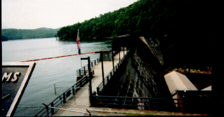
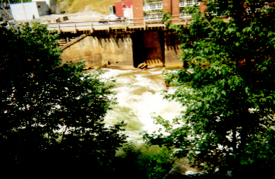
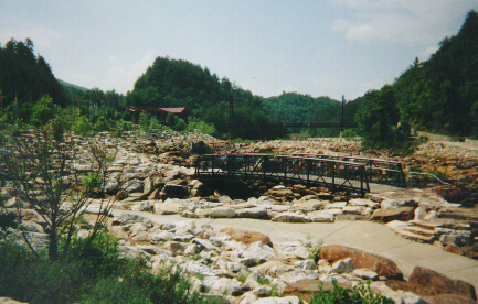
    This is the put-in point for rafts and kayaks on the Middle Ocoee segment. You're not supposed to raft or kayak over the dam itself; it's a $500 minimum fine. I spoke to a guy who's done it...twice. He was fined...once. :)
    Here is a look at the put-in ramp downstream from the dam
    Here's the dam itself. On the other side of the river is the beginning of the water flume. On rafting days in the evening the gates to the flume are opened and the water flows down the flume instead of over the dam, and then through the power turbines at #2 Powerhouse. Neet!
  11. You're getting close to Blue Hole and the Ocoee Whitewater Center now. Continue past the diversion dam (Ocoee #2 Dam) and about a mile farther you'll see another powerhouse across the river, with a green pipe and water tower. This is Ocoee #3 Powerhouse, and during most of the summer the Ocoee River is routed through a 2-mile tunnel bored through the mountain and out via this single, remarkably narrow pipe. On weekends, for special water events, TVA routes the water through the riverbed itself to allow kayakers and rafting parties to brave the Upper Ocoee. This photo of Ocoee Powerhouse #3 showing the pipe was taken from the driveway, after driving across the river on the bridge to the power station. 
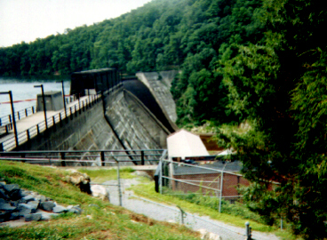
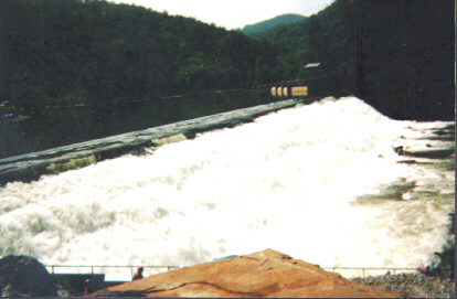
There are some informational displays about the generator's construction, the surge-tank and the tunnel through the mountain, so check 'em out sometime if you're an engineering geek like me. :)
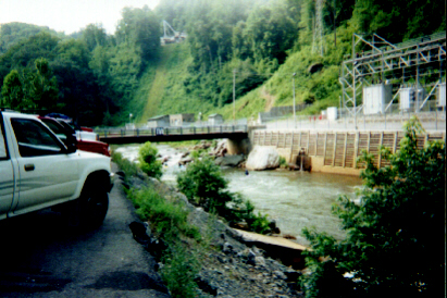
    Also located here is Thunder Rock Campground, along the river near the power-plant.
    Not too much farther and you'll see a brown sign saying "Ocoee Whitewater Center"; beyond this you'll see a parking lot on the right. Turn right here. You can park anywhere along the river here, but parking further up the hill puts you closer to the actual Blue Hole. You'll see pay kiosks with envelopes and stubs (for your dashboard or rearview mirror) located throughout the day-lot for the $3/vehicle day-use fee. You can also obtain a day pass or a 12-month annual pass at Recreation.Gov.
    Taken from the parking lot facing downriver Facing upriver: OWC was the red building in the distance at left OWC itself, taken from the short-term parking lot. R.I.P.
  12. Quick summary: I-75 N. to Ga 411, right on Ga 411 and go c. 70 miles to US 64; right on US 64 (left turn before the overpass) approx. 20 miles to the Ocoee Whitewater Center. It's only about three turns away!
------------ blue separator ------------------

1998 Roadtrip Diary | 1999 Roadtrip Diary | 2000 Roadtrip Diary | 2001 Roadtrip Diary | 2002 Roadtrip Diary |
2003 Roadtrip Diary | 2004 Roadtrip Diary | 2005 Roadtrip Diary | 2006 Roadtrip Diary | 2007 Roadtrip Diary | 2008 Roadtrip Diary | 2009 Roadtrip Diary | 2010 Roadtrip Diary |
2011 Summer Roadtrip Diary |

Top of Paul's home page
Books I'm reading now
My current fave musical vibes
All of my CDs
Music links
My own list of 500+ links
Personal info
Ways to contact me or chat online