The regular schedule of recreational water releases from Ocoee #3 for rafting and kayaking is located
here.
My 2026 schedule is posted here
List of all photos and videos now available here
List of all my yearly diaries and recaps is now here
|
|
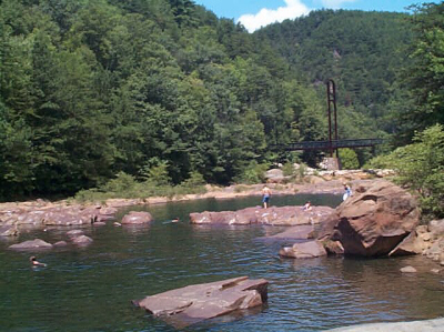
Blue Hole, looking downriver. The Centennial Olympic footbridge
is in the background and the best-known underwater tunnels are just to the
left out of frame.
|
Background:
Ever since 1994 or so, I've been roadtripping a lot up to Cleveland
Tennessee, where my longtime friends Dirk and Randall lived, to visit them
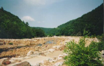
and go swimming in the Ocoee River Gorge. There's a great swimming hole called Blue Hole,
part of the Upper Ocoee River, where there are underwater tunnels shallow
and deep, wide and narrow; nice wide swimming holes 12-14 ft. deep; places
where you can jump in or go free-diving and look at the rocky bottom, in clear
mountain water. There are easy tunnels for the whole family to swim through,
and some that only kids (and skinny adults) can attempt, and some that no-one
I know of has succeeded in swimming through. It's a lot of fun! Great
weather, great swimming, great company, underwater tunnels....what more
could one ask for?
First, some important things to know:
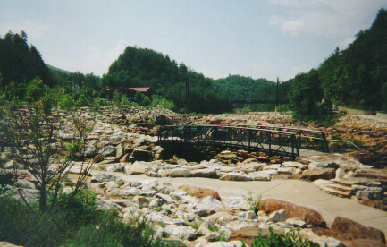
If you're like me, though, you'll probably want to go to Blue Hole itself. At the near side of the suspension bridge there is a round flagstone "plaza." Stairs and a ramp descend down to it from the old short-term visitors' lot, and a path, now blocked, used to lead to the back of the Center. You'll see a paved ramp heading down to the river and the Old Copper Road trail, and that is how you access Blue Hole and the underwater tunnels. Blue Hole is easily visible looking upriver from the suspension bridge, and the best-known tunnels ("swiss-cheese rock") are at the far end of that section, in the middle, as the water gets shallower heading there from Blue Hole. Look for a bunch of holes in the rock.
If you go up to Blue Hole this summer or any summer, be sure to
drop me a
note in email if you have any comments or suggestions. It's a great place to
go swimming or snorkeling!
If you'd like to make it an overnight trip, the closest motels
are in Ducktown, TN; you passed them if you approached from the east but they're a little pricey.
There are also various lodges, campgrounds and cabin-rental
places in the Cherokee National Forest. Thunder Rock Campground,
across the river near TVA's Ocoee #3 powerhouse, is only about 2 miles
from Blue Hole and costs $12/night for a spot. No permit or fee is required for
"primitive" camping up in the mountains within the National Forest,
but there are bears and stuff.
For more information about primitive camping, go
here.
In the event I don't stay with friends in Cleveland, TN, I
generally get a room in town there. There are numerous options at the I-75 exits.
If you'd like to picnic at Blue Hole, a bridge by the lower
"day" parking lot leads to a small picnic area across the river
from the parking lot. These tables and a larger covered pavilion are first-come first-served.
| Dates |
Plans |
Comments |
| May 12, 2026 |
Tuesday trip postponed
| Although THIS year the river flow looks to be okay for swimming, the weather and water are still too chilly (for me, anyway). Cold overnight temps in the upper 40s, and a daytime high of only 75F. |
| May 19, 2026 |
Tuesday trip made! |
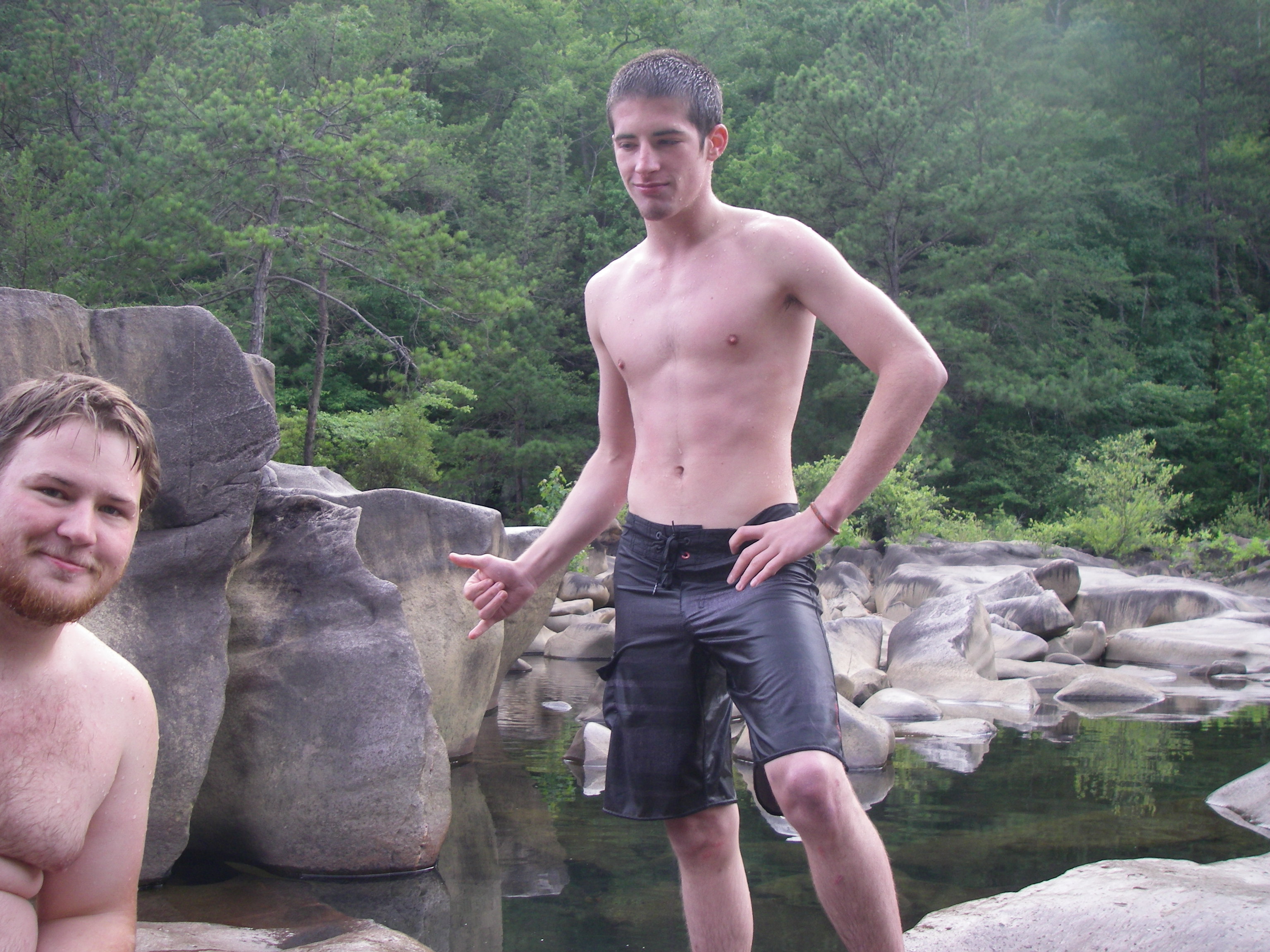
This ended up being a really awesome day, despite arriving late due to a missed connection.
Plenty of sunshine and the water topped out at around 82F, just about perfect. It was great to see Kyle H. from
previous visits, plus his two friends Devon and someone whose name I couldn't make out.
Only two videos and no photos from the trip, as I'd forgotten to charge up my Fuji underwater camera.
This one features Kyle and co. swimming in the underwater tunnels, while
this one shows a trip downriver from the tunnels to the deep part.
Both have been added to my newly-created
Blue Hole 2026 playlist.
|
| May 26, 2026 |
Tuesday trip cancelled |
The wet-weeather period that settled in right after that last visit has continued, and the forecast for the 26th showed cool, cloudy conditions and 100% chance of showers.
|
| June 2, 2026 |
Tuesday trip cancelled |
Due to a medical condition.
|
| June 9, 2026 |
Tuesday trip cancelled |
Due to clousy, rainy weather up at Blue Hole, with flood watches posted.
|
| June 23, 2026 |
Tuesday trip cancelled |
I'll be heading out of town on Wednesday and the forecast up in TN is rainy and a bit cool, so....
|
| July 3, 2026 |
Friday trip made! |
Since Friday was my in-lieu-of holiday, I headed up during the middle of a heat-wave. Sun and heat gave way to cloud-cover and nearby thunderstorns after I got there, but it was great to see some folks from prior years and meet Nikita, Daniel and family, who were very cool (originally from Ukraine, now in Tennessee). Videos have now been posted to my
2026 YouTube playlist!
|
| July 7, 2026 |
Tuesday trip made! |
Finally some sunny skies and warm temps! Water started at 82F and topped out at 86F, just about perfect. Great to hang out with Owen and Hannah, Xavier Pierce and Druid, Caleb, Cavan and Lauralee, Javon, Logan, Paul and Devonte, and Graeme and Haley, plus other folks. Videos are now posted in my
2026 YouTube playlist!
|
| July 14, 2026 |
Tuesday trip made |
"Hippie" Chris rode up with me, but the weather was a bit rainy and cool, and the water was cool (73F) and cloudy with the increase in rain and river-flow. We left after about two hours, ate at Habanero's in Copperhill, got to Mercier Orchards literally two minutes before closing (at 5 pm), but were still able to buy some fried pies. :)
I only got one short "tunnel" video, showing how cloudy the water was. I'll post it in a few days.
|
| July 21, 2026 |
Tuesday trip possible |
This will depend on weather and river-flow. Contact me if you'd like to ride up or meet up!
|
| July 28, 2026 |
Tuesday trip possible |
My schedule at work may change and no longer include Tuesdays off. (!) Contact me if you'd like to ride up or meet up!
|
| August 4, 2026 |
Tuesday trip possible |
This will depend on weather and river-flow. Contact me if you'd like to ride up or meet up!
|
| August 11, 2026 |
Tuesday trip possible |
This will depend on weather and river-flow. Contact me if you'd like to ride up or meet up!
|
| August 18, 2026 |
Tuesday trip possible |
This will depend on weather and river-flow. Contact me if you'd like to ride up or meet up!
|
| August 25, 2026 |
Tuesday trip possible |
This will depend on weather and river-flow. Contact me if you'd like to ride up or meet up!
|
| September 15, 2026 |
Post-DragonCon and -Progpower USA Tuesday trip possible |
This will depend on weather and river-flow. Contact me if you'd like to ride up or meet up!
|
| After September 15, 2026 |
more visits possible IF the weather stays warm |
Sometimes it stays warm into October; sometimes, like in 2025, it gets colder "right on schedule." We'll see.
|

